Frequently Asked Questions
-
The Rickenbacker Corridor is the transportation, ecological, and recreational corridor connecting mainland Miami to Virginia Key and Key Biscayne. It includes the Rickenbacker Causeway itself, plus the surrounding public lands, waterways, and community destinations that rely on or are shaped by the causeway’s presence.
The corridor matters because it does multiple jobs at once. On a typical day, it carries commuters and local traffic headed to and from Key Biscayne and Virginia Key, along with transit users, cyclists, and pedestrians using the shared-use path. During peak recreation times, it becomes a major access route for beaches, parks, and events. During emergencies, it functions as a critical response and evacuation route — in practice, it is the sole evacuation route for Key Biscayne and parts of Virginia Key, which raises the stakes for reliability, safety, and resilience.
-
Geographically, the corridor spans from mainland Miami across Virginia Key, over Bear Cut, and onto Key Biscayne. It also includes adjacent shorelines, Biscayne Bay waters, and connected parks and public facilities that sit along the route or depend on it for access.
In terms of infrastructure, the causeway is approximately five miles long and includes roadway segments, multiple bridge structures (most notably the Bear Cut Bridge), a shared-use path system for walking and biking, toll facilities, and adjacent shoreline areas. The corridor also connects major public destinations, including Virginia Key, Crandon Park, Historic Virginia Key Beach Park, and the Village of Key Biscayne, along with nearby educational, cultural, and recreational sites. So while people often think of it as “just the causeway,” the corridor is really a network of connected assets: transportation infrastructure + public lands + coastal ecosystems + community destinations.
-
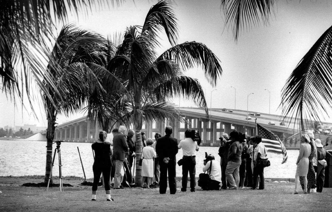
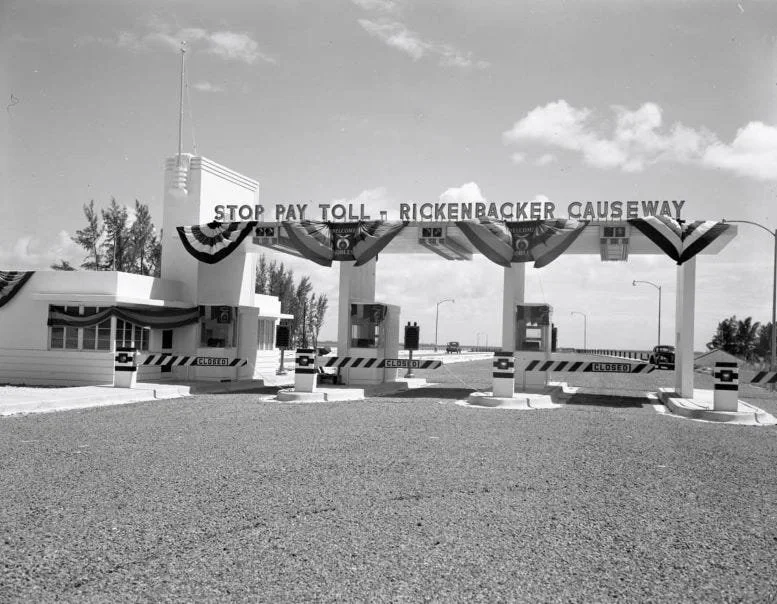
The Rickenbacker Causeway opened in 1947 to provide reliable access to Key Biscayne and support regional growth and recreation. Over time, it enabled residential development, park creation, tourism, and the growth of educational and cultural institutions on Virginia Key and Key Biscayne.
The causeway is named after Edward Rickenbacker, a nationally known aviator and civic figure. He was selected as the namesake in part because he served as a leader of Eastern Air Lines, which was headquartered in Miami at the time the causeway was named.
-
The corridor is aging and faces overlapping challenges that are difficult to solve with simple, isolated fixes. Current planning efforts are responding to issues like safety for all users, structural condition and long-term durability, sea level rise and flooding risk, congestion and peak-time demand, and multimodal access (how safely and efficiently people can travel by car, transit, bicycle, or on foot).
The goal of studying the corridor now is to understand long-term needs and options — not just for one segment or one type of user, but for the entire corridor system. Planning also has to account for legal, environmental, and public-land constraints, which can shape what is possible and how quickly changes can happen.
-
The Bear Cut Bridge project focuses on evaluating the condition and future of the bridge that connects Virginia Key and Key Biscayne. The bridge is approaching the end of its design life, which means long-term planning is necessary to ensure the connection remains safe and functional.
Multiple alternatives are typically studied, including rehabilitation, replacement, or reconfiguration, along with a “No Build” alternative that maintains existing conditions with basic maintenance. At this stage, no final decision has been made — the purpose of evaluating multiple alternatives is to understand feasibility, impacts, costs, and tradeoffs before moving toward any preferred direction.
-
Planning and engineering studies generally take several years. If an option is approved, it would still need to go through design development, permitting, and funding approvals before construction could begin. In other words, study and evaluation happen first, and construction (if it occurs) comes later after a longer chain of required steps.
-
Alternatives considered in corridor planning can include different bridge designs, roadway configurations, multimodal improvements (walking/biking safety, access changes, separation of uses), and shoreline strategies — including maintaining existing conditions.
One idea that often comes up in discussion is the “shoreline” or elevated causeway concept. This is described as a discussion-level idea that explores separating high-speed traffic from local and recreational uses, rather than mixing all users in the same space. It’s important to be clear: this is not an adopted or approved project; it is conceptual and has not been selected as an official proposal.
-
The Rickenbacker Causeway is owned and operated by Miami-Dade County. Responsibilities across the wider corridor are shared among Miami-Dade County departments, the Village of Key Biscayne, the Florida Department of Transportation, and state park agencies, depending on the location and the specific asset (roadway, bridge, park land, etc.).
Tolls are set and collected by Miami-Dade County. Discount programs exist for certain users, depending on county policy.
-
The corridor includes shared-use paths for pedestrians and cyclists, but conditions vary along the route. Because the corridor serves a mix of daily commuters, recreational visitors, and non-motorized users, safety is a central topic in ongoing studies.
Potential safety improvements that can be explored in planning include design changes, separation of different travel modes where feasible, and better crossings or access points. The exact approach depends on what is technically feasible, environmentally allowable, and supported through study findings and public input.
-
The causeway is a critical emergency response and evacuation route. For Key Biscayne and parts of Virginia Key, it is the sole evacuation route, meaning any disruption — from storm impacts to structural issues — can have serious implications. This reality is one reason resilience, redundancy planning, and safe operations are so important in long-term decision-making.
-
The corridor includes coastal waters and shorelines within Biscayne Bay, including mangroves, beaches, dunes, seagrass beds, and wildlife habitats. Key ecosystems in and around the bay include seagrass meadows, mangrove forests, sandy beaches, and marine habitats that support fish, birds, and other wildlife.
These natural systems are valuable in their own right, but they also influence how infrastructure can be maintained or adapted. Environmental protection is a major consideration in any future changes.
-
Sea level rise increases flooding risk, accelerates wear on infrastructure, and contributes to shoreline erosion in low-lying areas. Storms and hurricanes can cause flooding, wave damage, debris impacts, and temporary closures, which highlights the need for resilient design strategies.
Shoreline erosion — the gradual loss of land due to waves, currents, and storms — is occurring in several areas along Virginia Key and Biscayne Bay. One strategy being studied is living shorelines, which use natural features like mangroves, oyster reefs, and dunes to reduce erosion while supporting habitat.
-
Major parks connected by the corridor include Crandon Park, Bill Baggs Cape Florida State Park, and Historic Virginia Key Beach Park. Historic Virginia Key Beach Park is particularly significant because it served as Miami’s only beach for Black residents during segregation and is protected for its cultural and environmental value.
Public access to beaches and parks is managed through park operations, parking regulations, operating hours, and environmental protections. In addition, legal and environmental protections apply across the corridor’s public lands. These can include conservation designations, historic status, leases, covenants, and state and federal environmental regulations — all of which can limit or guide what changes are allowed, how land is used, and how public access is maintained.
-
Planning is led by Miami-Dade County in coordination with partner agencies and community organizations, including the Key Biscayne Community Foundation. Community members can participate through public meetings, workshops, surveys, and comment periods, which are shared through county and project websites and community channels.
Public input helps identify priorities, concerns, and values that inform studies and recommendations. Final decisions, however, rest with governing bodies, and approvals may be required from Miami-Dade County, state agencies, and potentially federal agencies depending on the project type and impacts.
-
Funding for improvements may include toll revenues, local funds, and state or federal grants, along with other public sources. In general, tolls often support operations and maintenance, while major projects typically require additional state or federal funding.
After planning studies are completed, if a preferred option is identified, next steps may include design, permitting, funding approvals, and construction planning. Official studies, plans, and documents are typically available through Miami-Dade County project pages and partner organization websites. Project websites also list contacts for specific questions or concerns, and updates are shared through public meetings, websites, email lists, and outreach efforts.